Nepal just made its boldest move in adventure tourism in years. The new Danphe Trekking Route, also called the Danfe Trail, was officially announced in Nepal's Fiscal Year 2026/27 federal budget as a leading project for ecotourism infrastructure, drawing immediate attention from trekkers, conservationists, and travel writers worldwide. This proposed corridor aims to connect the remote, largely unexplored landscapes of Western Nepal with the well-established trekking hubs of the central Himalayas.
Before you start searching for flights, one thing needs to be said clearly: the Danphe Trekking Route is not open yet. This is a proposed high-mountain eco-tourism corridor in the early stages of infrastructure planning, not a fully marked, commercially operated trail with teahouses and booking platforms. Think of it as Nepal's next big project.
The ambition behind it, though, is genuinely massive. The route is designed to bridge the untouched wilderness of Khaptad and Rara in Western Nepal all the way east to Muktinath in the Gandaki Province, essentially threading together ecosystems, sacred sites, and remote communities that have never been connected by a single trekking corridor. For a trekking world increasingly hungry for alternatives to Everest and Annapurna, this matters.
What Is the Danphe Trekking Route?
The Danphe Trekking Route Nepal is a proposed long-distance trekking corridor in Nepal and is being promoted as a future high Himalayas trekking route connecting Khaptad National Park, Ramaroshan, Badimalika, Rara Lake, Swargadwari, and Muktinath through the High Himalayas. Announced in Nepal's FY 2026/27 budget, the route aims to promote ecotourism, conservation, and regional development.
The concept is sometimes referred to as the Danfe Trail or Danfe Trekking Route (an alternate transliteration of the same Nepali word). Both names refer to the same proposed corridor.
Why Is It Called the Danphe Trekking Route?
The trail takes its name from the Himalayan Monal, Lophophorus impejanus, known locally as the Danphe. It is Nepal's national bird, a striking, iridescent pheasant found across the high Himalayan forests of the very regions this trail would pass through.
Naming the route after it is deliberate symbolism. The Danphe is a protected species, meaning it is legally off-limits for hunting. Tying the trail's identity to the bird signals that this corridor is being framed from the beginning as a conservation-first project, not just a tourism infrastructure play.
Why Nepal Created the Danphe Trekking Route?
Nepal's trekking economy has long been concentrated in two corridors, the Everest corridor and the Annapurna corridor. The Danphe Route is the government's most direct attempt yet to change that, a single infrastructure project designed to serve three goals at once.
1. Tourism Diversification and Expanding Beyond Everest and Annapurna
Nepal's FY 2026/27 budget, presented by Finance Minister Dr. Swarnim Wagle, explicitly frames the Danphe Route as an infrastructure decentralization strategy. The logic is straightforward: when 80 to 90 percent of trekking revenue flows through Everest, Annapurna, and the Langtang Region, the entire industry becomes vulnerable to disruption in those two corridors.
A long-distance western route spreads that risk while giving international trekkers a genuinely new destination, something the market has been asking for. If developed successfully, the route could become an important product promoted by the Nepal Tourism Board as part of Nepal's effort to diversify trekking destinations beyond Everest and Annapurna.
2. Regional Economic Development
Districts like Bajura, Kalikot, Mugu, and Humla sit right inside the proposed corridor and currently receive almost no tourism revenue. A formalized trekking route changes that directly, creating demand for local guides, porters, homestay hosts, and food suppliers without requiring communities to relocate or build expensive infrastructure from scratch.
The eco-tourism model also ties that income to conservation outcomes, so communities have a real financial reason to protect the landscapes trekkers come to see. For provinces that have historically been left out of Nepal's tourism economy, that kind of ground-level entry point matters more than large-scale investment alone.
3. Conservation and Eco-Tourism
The route is being developed under an eco-tourism framework from the start, not retrofitted with conservation principles after the fact. That matters because the corridor passes through or near Khaptad National Park, Rara National Park, and the Api Nampa Conservation Area, making conservation alignment not just strategic but necessary.
Getting that framework right early is non-negotiable. The high-altitude grasslands, alpine lakes, and wildlife habitat along this route are fragile, and experience from trails like the Annapurna Conservation Area shows that community-based management from day one produces far better outcomes than trying to course-correct later.
Planning Your Next Trek in Nepal? While the Danphe Trekking Route is still under development, Nepal already offers some of the world's most rewarding Himalayan adventures.
Explore expertly guided trekking experiences, travel guides, and adventure packages with Footprint Adventure.
Where Will the Danphe Trekking Route Pass?
The proposed Danphe Trail Nepal runs west to east across Nepal's High Himalayas as a new Himalayan trekking route Nepal connecting six major anchor destinations across three provinces.
Proposed Danphe Trekking Route Map and Key Destinations
Destination | Province | Key Feature | Current Trekking Status |
Khaptad National Park | Sudurpashchim | 225 sq km alpine plateau, rolling meadows, spiritual sites | Off-the-beaten-path; camping and basic homestays |
Ramaroshan | Sudurpashchim | 12 lakes, 18 green meadows (Patans), sacred landscape | Remote; camping only |
Badimalika Temple | Sudurpashchim | Sacred high-altitude grassland at 4,210m; views of Api and Saipal | Seasonal pilgrimage trail; camping required |
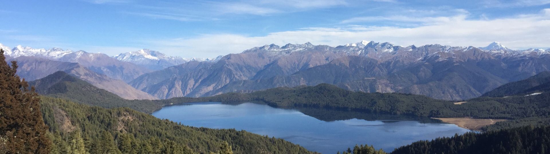
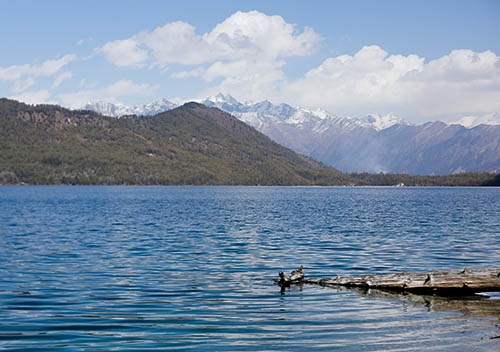
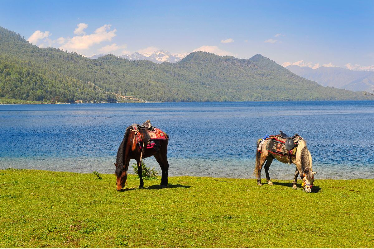
Rara Lake | Karnali | Nepal's largest lake at 2,990m elevation, covering about 10.8 sq km | Basic lodges and small hotels near Mugu |
Swargadwari | Lumbini | Sacred hilltop temple complex in Pyuthan | Road-accessible religious tourism site |
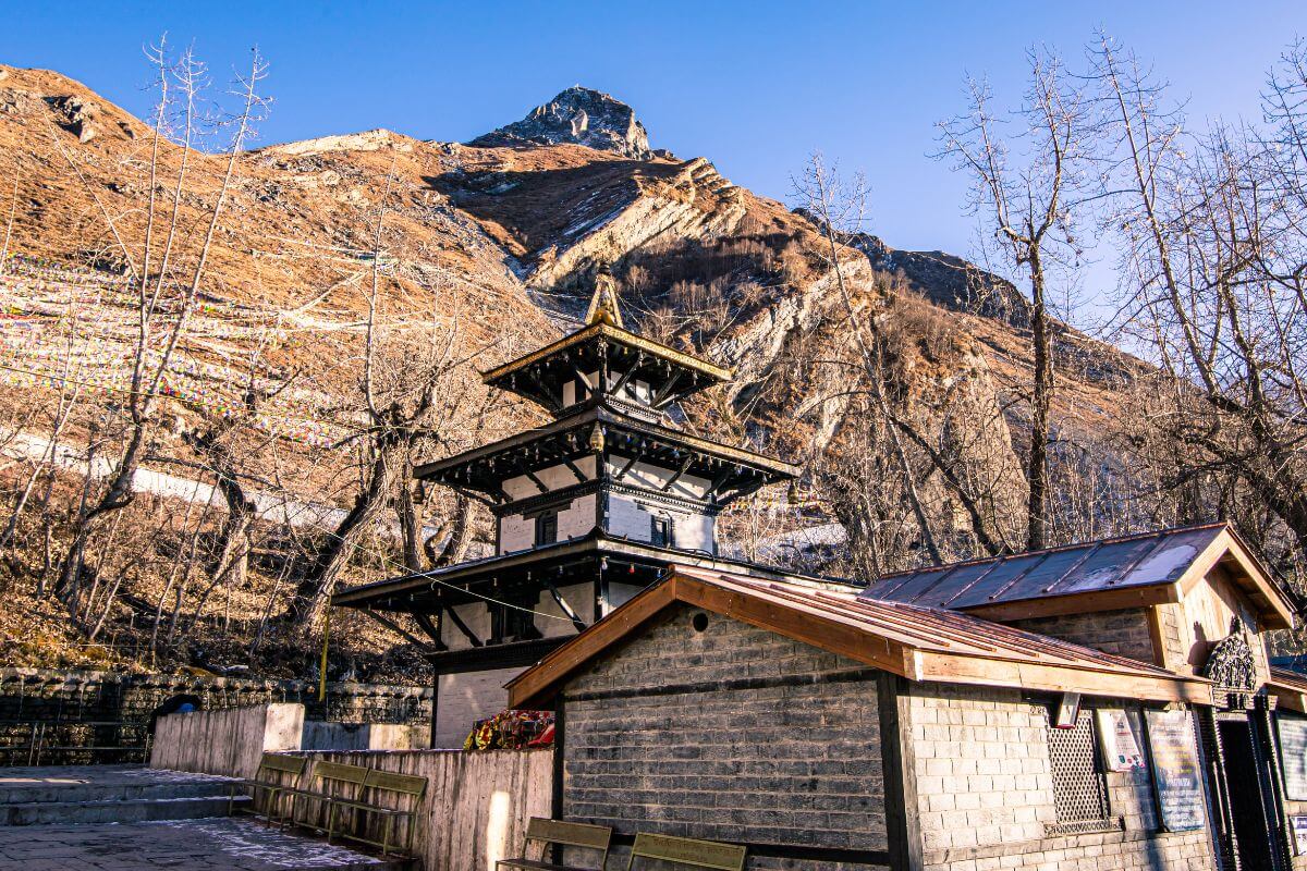
Muktinath | Gandaki | Sacred Vishnu temple complex with 108 waterspouts, 3,800m | Highly developed teahouse infrastructure |
Estimated Route Distance, Elevation, and Trekking Stages
Because this is still a proposed corridor, no official distances have been published. The figures below are preliminary estimates based on existing trekking knowledge of the regions involved.
Section | Estimated Distance | Elevation Range | Estimated Days |
Khaptad - Ramaroshan | ~80 - 100 km | 1,400m - 3,200m | 4 - 6 days |
Ramaroshan - Badimalika | ~50 - 70 km | 2,500m - 4,210m | 4 - 6 days |
Badimalika - Rara | ~90 - 110 km | 2,500m - 4,200m | 7 - 9 days |
Rara - Swargadwari | ~120 - 150 km | 1,500m - 3,200m | 8 - 10 days |
Swargadwari - Muktinath | ~100 - 130 km | 2,000m - 3,760m | 7 - 9 days |
Note: All distances and timings are preliminary estimates based on the proposed corridor concept. Official figures will be published as route development progresses.
Connecting Western Nepal Through the High Himalayas
The geographic ambition here is hard to overstate. Right now, Khaptad, Badimalika, and Rara operate as completely isolated trekking destinations. Each one needs a separate flight into a remote airstrip, separate logistics, and separate itineraries. They exist in different trekking universes, basically.
The Danphe Route proposes to stitch all of that into one continuous corridor, threading through districts like Bajura, Kalikot, Mugu, and Dolpo's terrain on its way east, creating the first high-altitude traverse linking Sudurpashchim Province to Gandaki Province entirely through the Himalayan belt. The route would also pass through landscapes shaped by the greater Dhaulagiri Himalayan ecosystem before reaching Muktinath.
How the Danphe Trekking Route Connects With the Great Himalaya Trail (GHT)
The Danphe Route and the Great Himalaya Trail overlap through Humla, Mugu, and Dolpo, making them complementary corridors rather than separate, unrelated trails.
Relationship Between the Danphe Route and GHT
The Great Himalaya Trail is a long-distance, high-altitude route that runs the full length of Nepal, roughly 1,700 km, from the far west to the east of Nepal. It already passes through several of the regions the Danphe Route would traverse, including Humla, Mugu, and Dolpo (Dolpa). Because both routes pass through parts of western Nepal, future connections between the Danphe Route and the Great Himalaya Trail may be possible if the project moves forward.
In practical terms, the Danphe Trail Nepal could function as a more accessible, lower-elevation alternative to some of the GHT's most demanding western sections or as a connector trail that allows trekkers to join and exit the GHT at multiple points.
Why This Matters for International Trekkers
The Danphe Route matters to international trekkers because it would open a continuous, defined trail through Western Nepal's least-visited Himalayan terrain. Regions like Bajura, Humla, and Mugu are currently among the hardest long-distance routes to access and navigate independently.
For trekkers interested in true long-distance Himalayan journeys, a developed Danphe Route could eventually make it feasible to link Khaptad, Rara, Dolpo, and Muktinath into a single multi-week expedition, something currently impossible without extreme logistical complexity.
Natural, Cultural, and Spiritual Attractions Along the Danphe Route
The Danphe Route covers more ground, literally and culturally, than almost any proposed trail in Nepal. In a single corridor, it combines Himalayan wilderness, active pilgrimage sites, indigenous communities, and some of the country's richest wildlife habitat.
1. Diverse Landscapes Across the High Himalayas
The Danphe corridor would pass through an extraordinary range of terrain. You would move from the rolling, flower-covered alpine meadows of Khaptad, where 567 species of flora have been recorded, through the high-altitude grassland plateau at Badimalika, down into the deep gorges of the Karnali River system, and across to the semi-arid, Tibetan-influenced highlands around Muktinath. Few routes in Nepal offer that kind of environmental variety within a single continuous trail.
2. Wildlife and Biodiversity
This corridor would pass through some of Nepal's richest wildlife habitat. Species you might encounter include:
- Himalayan Monal (Danphe), the trail's namesake and a Schedule I protected pheasant
- Red Panda, found in the temperate forests along the route
- Snow Leopard, present across the high-altitude terrain of Karnali and Gandaki
- Himalayan Tahr, commonly spotted on rocky cliff terrain above treeline
- Musk Deer, found throughout the mixed forest zones, particularly in Khaptad
Khaptad National Park alone hosts over 287 bird species and 23 mammal species.
3. Sacred Sites and Spiritual Heritage
Three of the six anchor destinations are major pilgrimage sites. Badimalika Temple (4,210m) is dedicated to Goddess Malika, a form of Bhagwati, and draws pilgrims from across Nepal and India during summer months. Swargadwari in Pyuthan is a hilltop complex sacred to Hindus, associated with the sage Shivapuri Baba.
Muktinath is one of the most sacred sites in both Hinduism and Buddhism, a Vishnu temple complex at 3,800m with 108 waterspouts, a flaming natural gas spring, and a location mentioned in the Mahabharata.
4. Traditional Communities and Local Culture
Western Nepal is home to some of the most culturally distinct mountain communities in the country. Many of these communities, particularly in Bajura, Kalikot, Mugu and Doti districts, practice lifestyles that have changed little over centuries, with traditional stone architecture, subsistence farming, and festival cycles tied to agricultural seasons. The Danphe Route would pass through this cultural heartland at a pace that allows genuine exchange, unlike fly-in fly-out tourism.
5. Conservation Benefits of Eco-Tourism
Framing this as an eco-tourism corridor matters. When trekking routes are developed with conservation principles from the start, involving local communities in management, limiting group sizes, and routing trails away from sensitive habitat, they can generate positive outcomes for the ecosystems they pass through. That is the stated ambition here, and the model has precedents in routes like the Annapurna Conservation Area's community-based approach.
Looking for the perfect trekking route in Nepal? Our local experts can help you choose the best adventure based on your experience, interests, and travel goals.
Danphe Trekking Route vs Other Famous Treks in Nepal
The table below shows how the Danphe Route compares against four of Nepal's most relevant remote treks.
Feature | Danphe Route | Rara Trek | Upper Mustang Trek | Dolpo Trek |
Development Level | Proposed | Moderate | Developed | Remote |
Accommodation | Mostly camping | Basic lodges | Teahouses | Mostly camping |
Cultural Experience | Diverse, multi-ethnic | Moderate | Strong Tibetan influence | Strong Tibetan influence |
Route Length | Long-distance corridor | Shorter trek | Moderate | Long expedition |
Permit Complexity | To be decided (multiple parks) | Moderate | Restricted area permit | Restricted area permit |
Potential Challenges in Developing the Danphe Trekking Route
The Danphe Route's biggest challenge isn't the terrain. It is everything that needs to exist before anyone can safely walk it. Five core problems stand between the current proposal and a commercially viable trail.
1. Permitting, Regulations, and Conservation Fees
The proposed route passes through or near multiple protected areas: Khaptad National Park, Rara National Park, and the Api Nampa Conservation Area, among others. These protected landscapes are among the most important conservation areas in Nepal. In practical terms, this means a future trekker will need a complex matrix of permits, potentially a TIMS card, separate national park entry fees for each protected area, and possibly restricted area permits for sections passing through Dolpo or Humla.
Permit structures will need to be designed to be manageable for independent trekkers while still generating meaningful conservation revenue. Future implementation will also likely require coordination between government agencies, local communities, and the Trekking Agencies' Association of Nepal to establish safety standards, guide regulations, and sustainable tourism practices.
2. Infrastructure Requirements
This is the central challenge. Building a commercially viable long-distance route will require trail marking and maintenance, emergency infrastructure (helicopter landing zones and first aid posts), and a minimum-viable accommodation network across hundreds of kilometers of remote terrain.
3. Environmental Sustainability
The ecosystems along this corridor are fragile. High-altitude grasslands, alpine lakes, and the habitat of snow leopards and red pandas are all sensitive to the kind of disturbance that poorly managed trekking routes can cause. Getting the environmental management framework right from the beginning is non-negotiable if this route is to avoid the damage patterns that have affected more established trails.
4. Balancing Tourism and Conservation
The long-term management question is how to keep tourism and conservation interests aligned once commercial operators begin offering packages. Experience from other Nepal routes suggests that without strong institutional oversight, the conservation framing can erode over time as commercial pressure increases.
5. High-Altitude Acclimatization and Terrain Challenges
The proposed corridor spans elevations from roughly 1,400m in lower valleys up to 4,210m at Badimalika and around 3,800m at Muktinath, with high ridges and passes in between. The elevation variance is significant, and on an undeveloped route without reliable rescue infrastructure, the risk of acute mountain sickness (AMS) is a genuine safety concern.
Proper acclimatization will be one of the most important factors for a safe journey. Any future commercial operation of this trail will need a clear acclimatization protocol built into itineraries and emergency evacuation plans for high-altitude sections where the nearest hospital is multiple days away. Preparing for such a demanding journey may require following a structured trekking training plan.
How Much Could the Danphe Trek Cost in the Future?
Costs remain speculative (a guess) because the route is still a proposal, but useful comparisons exist with similar remote treks in Nepal.
Expected Budget Range
No official pricing exists yet, but three comparable remote treks give a realistic benchmark for what the Danphe Route might cost once developed.
Trek | Estimated Cost (USD, guided) |
Rara Lake Trek (15 days) | $1,500 – $2,800 |
Upper Mustang Trek (14 days) | $1,990 – $3,520 |
Dolpo Trek (21+ days) | $3,500 – $5,500 |
Danphe Route (full corridor, estimated) | $4,000 – $7,000+ |
A full Danphe corridor trek would likely be priced toward the Dolpo end of the spectrum, given comparable logistics complexity, camping requirements, and remote location. Such a long expedition will require careful planning and a complete trekking preparation guide.
Potential Daily Trekking Costs
Once developed, daily costs would likely include:
- Camping logistics: $20-35/person/day for tents, cooking equipment, and camp setup
- Guide and porter costs: $35-60/day for a licensed guide, $20-30/day per porter
- Permits: Variable, potentially $50-150 total across multiple protected areas
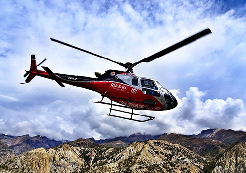
- Transportation: Domestic flights to/from remote airstrips (Talcha, Dhangadhi, Jomsom) add $200-400 per person
Final Thought
The Danphe Trekking Route through the High Himalayas could eventually become one of the Nepal's most ambitious trekking infrastructure announcements in a generation. Proposed under the FY 2026/27 national budget by Finance Minister Dr. Swarnim Wagle, it represents a genuine shift in how Nepal thinks about adventure tourism, moving away from doubling down on overcrowded hubs and toward unlocking the staggering, largely unseen potential of its western landscapes.
When fully developed, a route connecting Khaptad, Ramaroshan, Badimalika, Rara, Swargadwari, and Muktinath would give Nepal something it doesn't currently have: a long-distance, high-altitude corridor that crosses the country's wildest, most ecologically rich, and most culturally authentic terrain. But for trekkers willing to watch this space, the Danphe Route has the potential to become one of the most important and rewarding Himalayan trekking corridors in the world.
Inspired by the future Danphe Trekking Route? Discover Nepal's most popular trekking destinations and start planning your next Himalayan journey today.
Frequently Asked Questions About the Danphe Trekking Route
Is the Danphe Trekking Route open for trekking today?
No. The Danphe Trekking Route is a proposed infrastructure project announced in Nepal's FY 2026/27 budget. It is not yet open, marked, or commercially available for booking. Some sections pass through existing trekking areas (Khaptad, Rara, Muktinath) that can be visited independently.
Where does the Danphe Trekking Route start and end?
The proposed corridor runs from Khaptad National Park in Sudurpashchim Province in the west to Muktinath in Gandaki Province in the east, passing through Ramaroshan, Badimalika, Rara Lake, and Swargadwari.
Will the Danphe Route be a teahouse trek or a camping trek?
The Danphe route most probably will have a hybrid model once developed, as the western sections (Khaptad, Badimalika, and Rara) have minimal lodge infrastructure. Muktinath at the eastern end has full teahouse facilities.
How long would it take to trek the entire Danphe Route?
Based on preliminary estimates, trekking the full corridor from Khaptad to Muktinath would take approximately 35-45 days. Individual sections could be done in shorter trips once the route is developed.
When is the route expected to be fully developed?
Given the scale of infrastructure required, including trail marking, accommodation, and emergency systems, a realistic estimate would be hard to expect.
What wildlife can be found along the route?
The corridor passes through habitats supporting the Himalayan Monal (Danphe), red panda, snow leopard, himalayan tahr, and musk deer.
What permits might trekkers need in the future?
Expect a combination of a TIMS card, a Khaptad National Park permit, a Rara National Park permit, and potentially restricted area permits for sections passing through Dolpo, Humla, or Mugu. The exact permit structure will be determined as the route is formalized.